In the blog post from 17 May 2022 I asserted: “Because of their deep knowledge of battles, units and leaders, tour guides can often connect the dots and explain relationships that visitors with a limited knowledge of military history might miss.” Here are a few examples that cropped up during discussions with clients and friends over the past week.
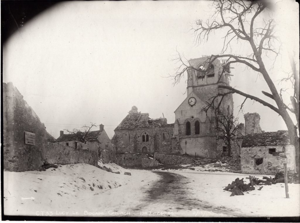
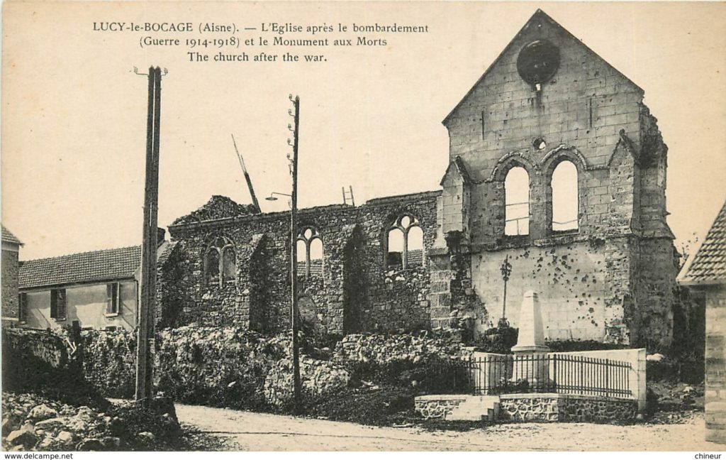
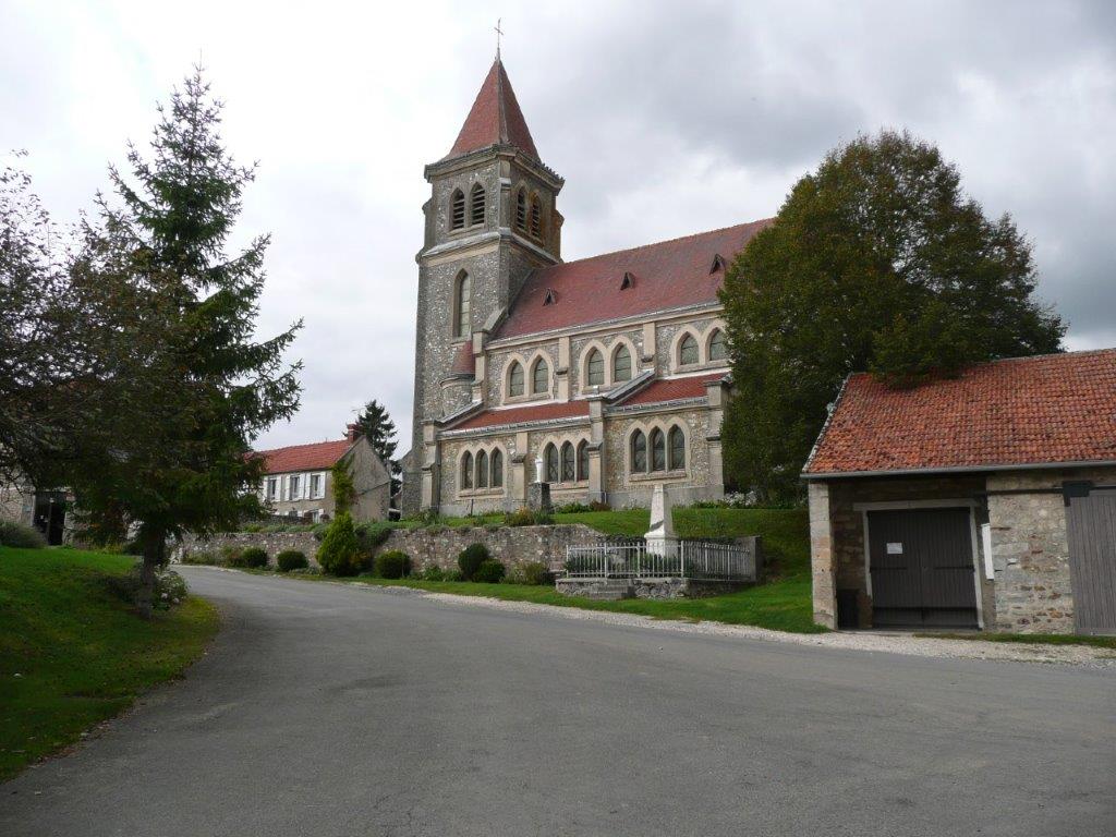
Rebuilt Church at Lucy-le-Bocage (Aisne-Marne, WW1)
In 2018 a more experienced tour guide (Markus Klauer) explained: “when looking at a battlefield, one has to be mindful of what happened during the war, immediately after the war, and during the 100+ years thereafter.” The church at Lucy-le-Bocage is an oft-visited site because of its proximity to Belleau Wood and the fighting of early June 1918. In the majority of cases French towns were rebuilt (using reparation funds) exactly as they were pre-war. In other cases, there are subtle differences, so one needs to be careful when lining up photos or maps. In the case of Lucy-le-Bocage, the church was rebuilt placing steeple on the opposite end of the church. This can be seen by comparing the current (2017) photo with the two post-war photos below. The stone wall, the WW1 memorial and the road curve line up to confirm this.
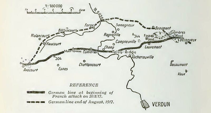
Meuse-Argonne AEF Jump-off Lines and the Battle of Verdun (WW1)
The map below can be found in signage atop Hill 304 west of Verdun. It shows the ground (re)gained by the French in their August 1917 Verdun Offensive. Expressed another way, the AEF jump-off lines in the Eastern portion of the Meuse-Argonne Sector in September 1918 were largely determined by the ground recaptured by the French a year earlier. Most Americans do not spend much time thinking about the geographic overlap of those two battles.
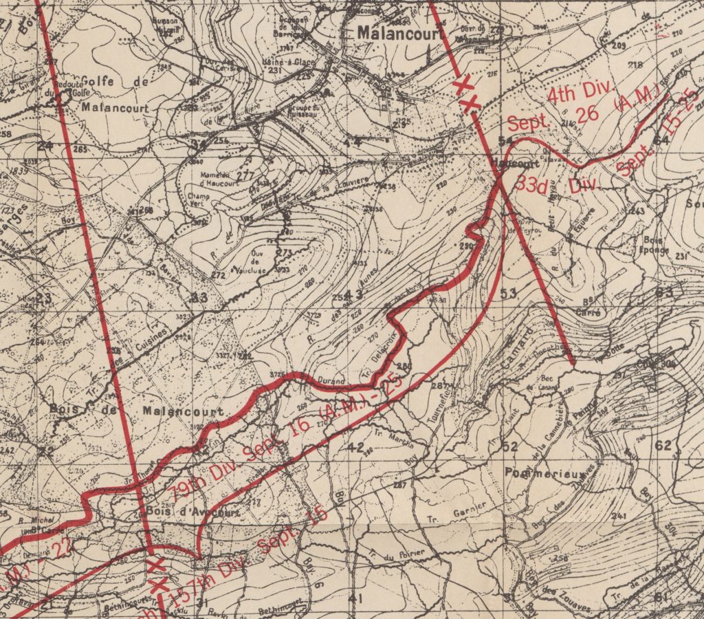
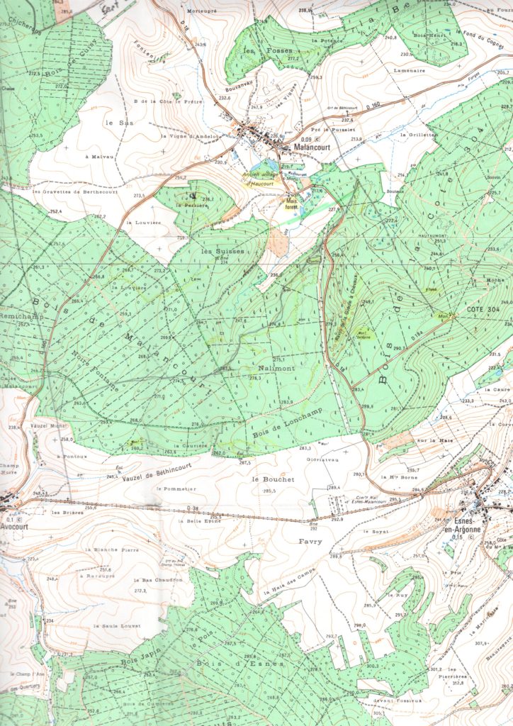
Zone Rouge and Reforestation Alters the Verdun and Meuse-Argonne Landscape too (WW1)
The French government’s decision in the 1920s and 1930s to use forestation to help reclaim large portions of the “Zone Rouge” mean that the battlefield was forever altered. On one hand, it has helped to preserve trench lines and other remnants. On the other hand, the visibility is not the same as it was in 1914-18. As a result, it is best to compare today’s IGN maps with period maps. The example below shows the location of the 79th Division’s jump-off trenches near Malancourt and the creation of the post-war forest.
What about WW2?
The relationships between key leaders and units between WW1 and WW2 is just as fascinating. During our Fall 2022 / Winter 2023 presentation season Markus and I intend to offer one presentation showing key WW2 leaders who also served in WW1 and a second presentation examining German and Allied units that saw action in both, the Normandy Landings and the Ardennes Offensive. Our schedule will be posted later this year. Stay tuned!
#kneedeepintohistory #ww1tours #ww2tours #battlefieldtours #meuse-argonne.com
Most intresting to me was the map with the relationship of Hill 304 to le Mort Homme. My Viet Nam marine friend and I tramped around 304 several times in the early 90’s. Ken